🗨 About Me
I am Yifan Yang, a third-year Ph.D. student in the Department of Geography at Texas A&M University, advised by Dr. Lei Zou in the Geospatial Exploration and Resolution (GEAR) Lab. My research centers on Responsible GeoAI and Autonomous GeoAI for explainable spatial reasoning under incomplete, changing, and real-world observations. Beyond my research, I founded AutonomousGeoAI4Science, an open community hub for papers, tools, benchmarks, and collaboration. My doctoral committee members are Dr. Heng Cai, Dr. Andrew Klein, and Dr. Zhengzhong Tu.
🔭 Vision: To transcend the boundaries of screens and make the real world our playground of intelligence — where AI, space, and humanity coexist and co-create.
Before starting my Ph.D. studies, I earned a master’s degree in Spatial Data Science from the University of Southern California. During my master’s, I worked with Dr. John P. Wilson on the Urban Trees Initiative, where I explored geospatial approaches to urban sustainability. Under the mentorship of Dr. Siqin Wang, I also completed a research internship at the Spatial Data Lab, Harvard University, which further strengthened my expertise in Geospatial AI and interdisciplinary data science.
Prior to graduate school, I received a bachelor’s degree in Software Engineering from Hainan University in China. I’m also an AI4Science enthusiast, and my hobbies are basketball🏀, football⚽, golf🏌️♀️, poker🎴, and talk shows🎆.
📄 Curriculum Vitae: View CV (last updated: September 5, 2026)
Research interests:
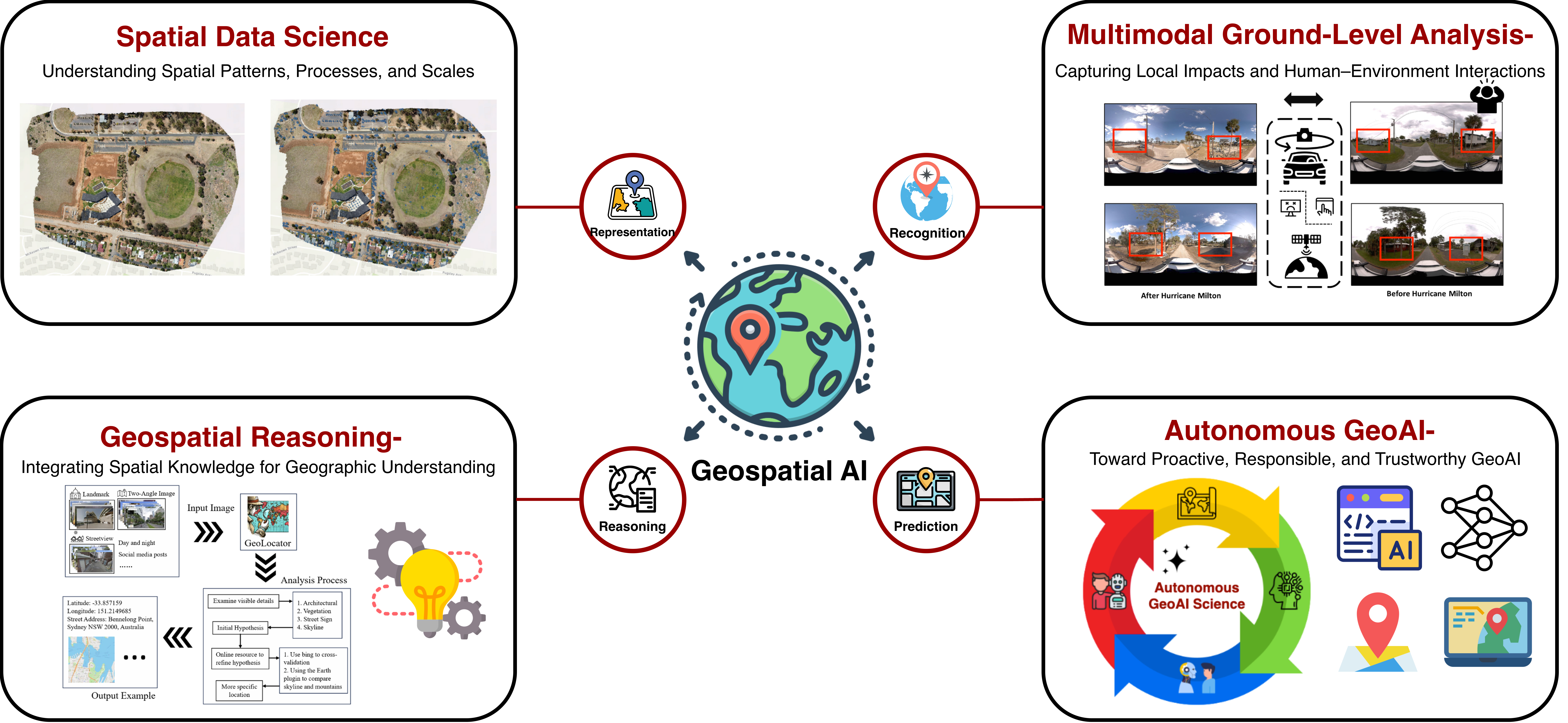
My current research interests mainly lie in Geospatial AI, especially in:
- Spatial Reasoning under Incomplete Observation: Real-world geographic evidence is never complete — imagery arrives stale, views are partial, and coverage is biased. A model must reason from fragments and, crucially, know when the evidence supports action and when it does not.
- Cross-View Evidence Fusion: Aerial and ground-level views often tell conflicting stories about the same place. How should a model arbitrate disagreeing observations, weigh the credibility of each source, and fuse them into a single defensible judgment?
- Closed-Loop Autonomous GeoAI: Moving beyond one-shot prediction toward agents that sense, reason, decide, and re-observe — closing the loop so that every geospatial decision builds on what earlier observations revealed.
Keywords: